There are times when technology is terrific and others … well. We set “sheila” the google maps lady to take us towards the Dingle Peninsula and I am not sure what her settings are at the moment (am convinced it is ‘torment the tourist mode’) but she sent us up hill, in decreasingly smaller roads, until the road became a track across the paddock. Jo and I remember such a roller coaster when we had “plastic patsy” the Tom Tom and only panicked a little.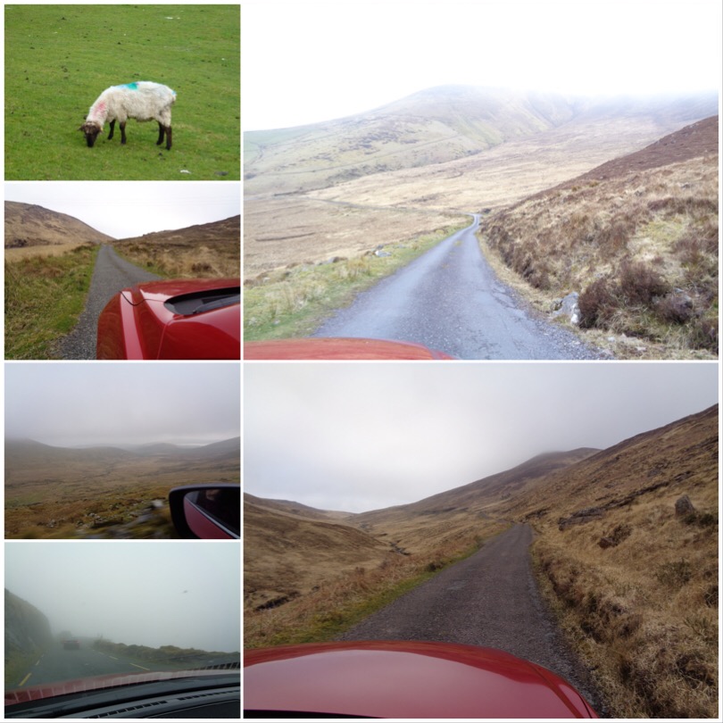
Up hill, down dale, beside this cow shed, over this blind hill, between these rocks, avoid those sheep until we emerged on route after what seemed like a major expedition to the wilds of Dingle. We then headed to Conor’s Pass, what turned out to be a sheep track clinging precariously to a green cliff, in deepest fog and cloud cover. Our outside visibility was a few meters- terrifying and hilarious on a single carriageway when you meet traffic coming the other way.
We survived, and headed to the cliffside drive that took us past the Potato Famine huts. When times were hard, and the potato crop failed, peasants did it tough. We saw tumble down stone stacks that were used as houses, along with tiny cottages that had many families crowded into them, perched on bleak hills being pummelled by stiff cold sea breezes- I think I would have made a lousy potato farmer.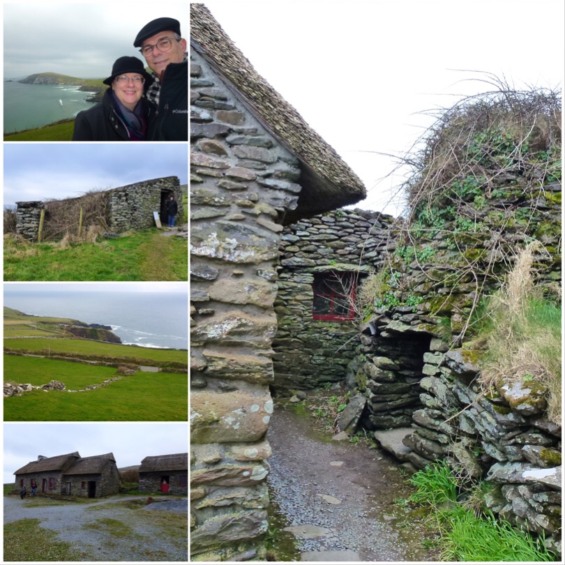
Among the cottages was an original ‘Beehive hut’ – a glorious ovoid hollow stacked stone structure that apparently were used originally by reclusive devout pilgrims for leading humble lives in, later for outdoor toilets and pig houses. Among the ruins were stone burial mounds (infant mortality was so high, unemployment was crippling so there was little to do but make babies). The church old not let unchristened kids be buried in church graveyards so families were forced to bury them at home. So tragic. We also saw the remains (much less than half) of an Iron Age Ring fort perched on a cliff, most of which had long tumbled into the sea.
The countryside is a green patchwork of stone walled fields, windswept sheep and boggy ground – every green there is.
Heading down the peninsula the sea views are stunning. Lots of inlets, rough cliffs, rough deep seas and Irish Mist making for some amazing views. My daughter and son in law had raved about a cliff and cove after their visit to Ireland and we sought out the same location. A cliff with a ziggy zaggy walk down to a beach. Before heading down we noticed someone had written “IRLAND 2018” in the sand below in huge letters. We decided to walk down, I needed to fix the spelling. When we returned to the top we had a picnic lunch which was pretty spectacular.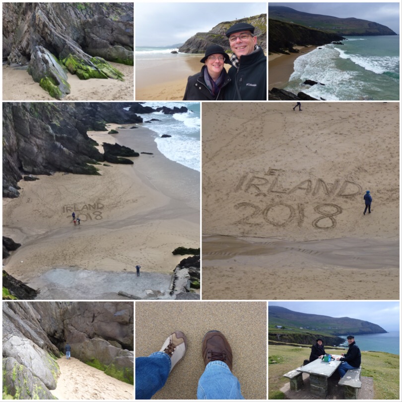
We drove on and noticed a sign that said “ferry stop”. Confused how this was even possible given the clifftops we were driving around we noticed a pullover and path leading cliffward, and decided to take it. There was a Ziggy zaggy ramp/causeway that wove its way down the side of the cliff, steep but walkable with stunning views of the bay and you could make out the Skellig Islands in the far distance, famous recently as the island used as Luke Skywalkers retreat. You can get to it but we decided a day in turbulent seas was not something we wanted to do. The views down and up were amazing. Lobster boats and pots at the bottom, nesting terns on the cliffs above us, just wonderful. Walking down meant walking back up, that achieved we thought we had earned caffeine.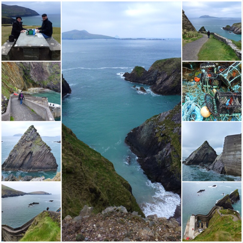
Thoroughly wind blown and cold to the core, we headed to the Blaskett Centre (a tourist hub) for a cup of tea and to thaw out of the wind for a while. I say tea, but warm wet disappointment is closer to the truth. Fortified and warmer, we continued around the coast then headed a little inland looking for an ancient building. After a false start (an enterprising farmer had set up a ‘free’ carpark then charged tourists to cross his land to get to a public monument) we found the free free carpark and walked to the Gallarus Oratory, an astonishing stone stacked structure that has survived centuries largely intact -a marvel of ancient engineering.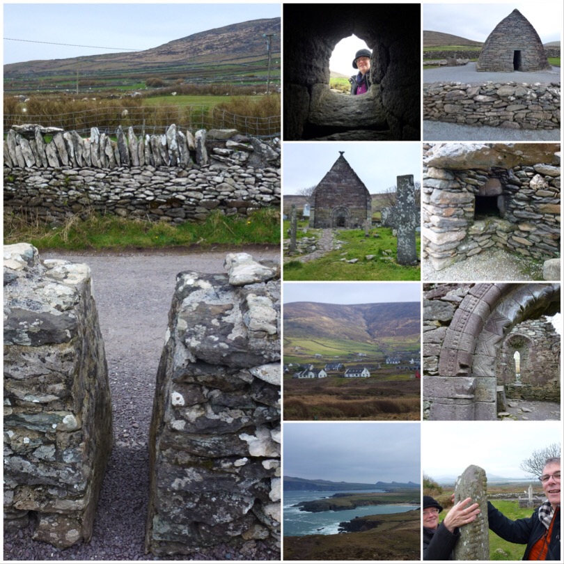
A wild goose chase later (trying to follow signs written in Gaelic is an exercise in surrealism) and we found the tumble down remains of an ancient church at Cill Mhaoil-cheadair to once again marvel at the architecture. When nature gives you tons of flat stones, you stack them into structures, buildings and fences. Among the more recent ruins was an ancient stone with a hole in it – according to tradition we touched thumbs through the hole and renewed our marriage vows – naawww.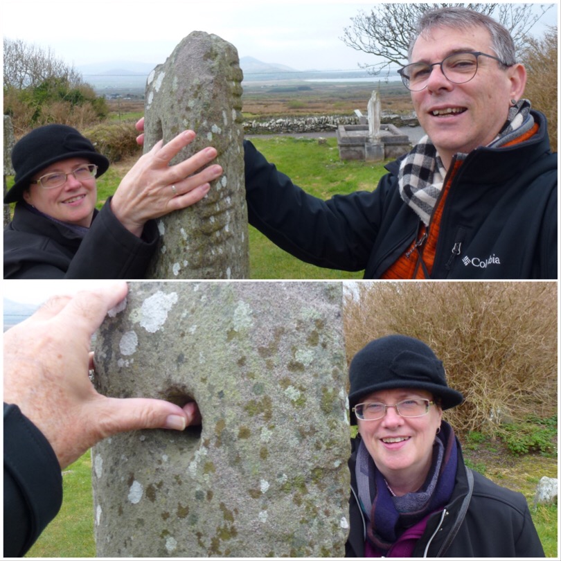
So, recently re-hitched, we returned to the township of Dingle, passing a ‘Fairy Fort’ – a small stone house with an intact bread oven and livable floorplan. At Dingle we had ice cream to celebrate our day before the drive back home. It was a brilliant day, even though the sky remained a fairly uniform shade of grey, we saw lots more and have hundreds of photos for just this day, but this post gives you a sampler of the wonderland that is The Dingle Peninsula. If we had to compare it with ‘The Ring Of Kerry’, This would win hands down in terms of scenery.

